 |
 |
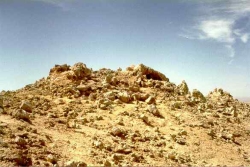
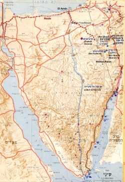
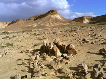
The 40 years of "wandering" in the Sinai following the יְצִיאָה was entirely confined to the northern third of the סִינַי. During that period, Israel ventured no further south than the northwestern environs near קָדֵשׁ בַּרְנֵעַ (1-2 ב) and הַר כַּרְכֹּם (1-2 א-ב) = הַר סִינַי in מִדְבָּר פָארָן (2 א-ב) of the Israeli נֶגֶב. הַר כַּרְכֹּם is 105km (as the crow flies, 66 mi.) south of בְּאֵר שֶׁבַע.
 |
Criticisms of this explanation, by Israeli archaeologists, are based on two most unscientific and foolish grounds:
Italian Archaeologist Emmanuel Anati maintains that the artifacts he found on הַר כַּרְכֹּם, some of which are dated as early as BCE 22nd century, therefore (?!?) fix the date of the יְצִיאָה to that period.![]() As most archaeologists agree, dating the יְצִיאָה to BCE 22nd century is clearly absurd. Duh, the mountain was clearly regarded as sacred by ancients, perhaps dating back to the Neolithic Period. That in no way precludes later peoples from also considering the site sacred; nor does it in any way affect the dating of the Yᵊtzi•âhꞋ!!! Despite the logical blunder relative to chronology, however, Anati has correctly identified Har Sin•aiꞋ.
As most archaeologists agree, dating the יְצִיאָה to BCE 22nd century is clearly absurd. Duh, the mountain was clearly regarded as sacred by ancients, perhaps dating back to the Neolithic Period. That in no way precludes later peoples from also considering the site sacred; nor does it in any way affect the dating of the Yᵊtzi•âhꞋ!!! Despite the logical blunder relative to chronology, however, Anati has correctly identified Har Sin•aiꞋ.
Archaeologists base their rejection of הַר כַּרְכֹּם as הַר סִינַי on the same colossal oversight—failure to recognize that:
הַר סִינַי/כַּרְכֹּם was widely revered as one, particularly important, of many holy mountains from time immemorial. It's virtually certain that proto-Israeli artifacts were crafted by preceding nomads for millennia before the יְצִיאָה and
the •vᵊr•uꞋ/עִבְרִים from c. BCE 2200 – i.e. the time of Sheim, Khâm and Yâph•eitꞋ (bᵊ-Reish•itꞋ 10.1) and EiꞋvër (bᵊ-Reish•itꞋ 11.14)![]() – were drawn to הַר סִינַי/כַּרְכֹּם and revered it for the same reasons – around 300 years before Yi•sᵊr•â•eilꞋ even existed (viz. obtaining his new name c. BCE 1800), and more than half a millennium before the Yᵊtzi•âhꞋ!
– were drawn to הַר סִינַי/כַּרְכֹּם and revered it for the same reasons – around 300 years before Yi•sᵊr•â•eilꞋ even existed (viz. obtaining his new name c. BCE 1800), and more than half a millennium before the Yᵊtzi•âhꞋ!
There is a real estate axiom: "Location, location, location". Sometimes ignoring this axiom (and ignoring 14C-dating, etc.![]() ), archeological dating, until recently dangled their asserted datings solely from a stratigraphical thread based on shard finds that, in the early days, were dug haphazardly based on explorers' hunches. The resulting (traditional arts-degreed humanities, in contrast to more recent scientist) archeologists' dating is almost comically riddled with inaccuracies and extensive early mistaken assumptions.
), archeological dating, until recently dangled their asserted datings solely from a stratigraphical thread based on shard finds that, in the early days, were dug haphazardly based on explorers' hunches. The resulting (traditional arts-degreed humanities, in contrast to more recent scientist) archeologists' dating is almost comically riddled with inaccuracies and extensive early mistaken assumptions.
While there have been many misidentifications of ancient sites and even cities that have been covered-over and lost, locations of entire mi•dᵊbârꞋ regions don't just hop around the map to fit theories driven by religious assumptions. The Yᵊtzi•âhꞋ commuted through Mi•dᵊbarꞋ Tzin and Mi•dᵊbarꞋ Pa•ranꞋ, neighboring Qâ•deishꞋ Bar•neiꞋa and unambiguous corroborating locations. Particularly Christian Humanities-archeologists have been so self-contradicting that they had to multiply Mt. Sinai into a number of different mountains to fit their silliness! Datings improve, but locations don't change. The scientist must subordinate post-135 C.E. Roman Hellenist-Christian mythologies and hypothesis to known locations.
When a location is fixed, dating then becomes a sometimes gnarly challenge within that constraint.
Practically universally, Christian, Muslim and Jewish scholars alike have gullibly succumbed to a post-135 C.E. Roman, Hellenist-Christian (i.e. miso-Judaic) tradition that boiled-over (and still lingers today) as the product of their destruction of the Beit ha-Mi•qᵊdâshꞋ and expulsion of Jews from Yᵊru•shâ•laꞋyim in 135 C.E. This motivated the original Christians (Pauline Hellenists, predominated after 135 C.E. by miso-Judaic Roman gentiles, not Jews), whenever viable, to eschew everything Judaic. This miso-Judaic bias accepted only "Christian" locations, exacerbated by two faulty, predominantly Christian, assumptions:
that avoiding going through Pᵊli•shᵊt•inꞋ implied turning south immediately from Yâm Suph (though not even knowing Yâm Suph from the Red Sea) thus assuming they therefore never reached el-Ar•ishꞋ, and
post-135 C.E. Roman Hellenist-Christian mythology, promulgated by Empress Consort Helena, mother of Constantine the Great in the 4th century C.E., that Har Sinai had to be a majestic mountain in the southernmost region of the Sinai peninsula – despite locations explicitly declared in the Scriptural text
According to the early Roman Hellenist-Christian requirements then,![]() perhaps the only village – en route to a majestic mountain in the south – that has many date palms is el-Tōr (from the Arabic term for the mountain along the "Southern Route" alleged by Christian and Muslim mythologies to be where Mōsh•ëhꞋ received the Tōr•âhꞋ from י‑‑ה). As noted by botanist Avinoam Danin: "We turned [our discussion] to the date palms and I related my enthusiastic memories from a spring in the extreme desert near A-Tor, southern Sinai, where hundreds of wild date palms grow."
perhaps the only village – en route to a majestic mountain in the south – that has many date palms is el-Tōr (from the Arabic term for the mountain along the "Southern Route" alleged by Christian and Muslim mythologies to be where Mōsh•ëhꞋ received the Tōr•âhꞋ from י‑‑ה). As noted by botanist Avinoam Danin: "We turned [our discussion] to the date palms and I related my enthusiastic memories from a spring in the extreme desert near A-Tor, southern Sinai, where hundreds of wild date palms grow."![]()
It may surprise some readers to learn that scholars agree that the popular tourist spot, Mount St. Katherine's, near the southern tip of the Sin•aiꞋ peninsula, cannot be the Har Sin•aiꞋ of Ta•na"khꞋ! It should be noted that Har Sin•aiꞋ was the sacred (thus, off-limits to everyone but Mosh•ëhꞋ) destination of pilgrimages, not an inhabited city where extensive refuse shards or village walls should be expected. The people lived nearby (perhaps in Qâ•deishꞋ Bar•neiꞋa, perhaps even Bᵊeir ShëvꞋa). Consequently, it should be no surprise that archeologist Prof. Emmanuel Anati conceded: "Like in other areas of the NëgꞋëv and Sin•aiꞋ, none of the recorded sites seem to date between 2000 and 1100 BC. No traces of human presence were found…" (The Yᵊtzi•âhꞋ occurred near the midpoint of that lacunae.![]()
 |
I think Italian archeologist Emmanuel Anati is right when he identities the true הַר סִינַי with הַר כַּרְכֹּם (1-2 א-ב), another 40 km southeast of קָדֵשׁ בַּרְנֵעַ (1-2 ב) in the NëgꞋëv of Israel.![]()
הַר-שֵׂעִיר is likewise identified with הַר-שָׁזַּר, easily confused in ancient Hebrew, or another nearby hill (2א).
A fortiori, this identification satisfies Dᵊvâr•imꞋ 1.2 and other descriptions.
Though some have ruled out Har Kar•komꞋ based on exceeding (by 1 day!) their estimate of the number of days walking distance documented from known points in Ta•na"khꞋ, it turns out that they underestimated a day's walking distance as proven by the hard evidence of the distance between caravansaries in the region – 30 km, which, following the circuitous caravan route, exactly fits Har Kar•komꞋ!
The only mountain that fits all of the requirements is Har Kar•komꞋ, adjacent to Mi•dᵊbarꞋ Tzin and Mi•dᵊbarꞋ Pa•ranꞋ in the Israeli NëgꞋëv.![]()
Any hard evidence that might remain of the Yᵊtzi•âhꞋ, including remains of chariots, should be sought along the route eastward from the reed marshes of the northeast Delta. The area in question was greatly changed in the modern era by the digging of the Suez Canal. Muslims digging the canal concealed and destroyed any contra-Islamic evidence encountered during construction – as they've been well documented doing on Har ha-BaꞋyit and across the Middle East from Syria to Iraq. Evidence may also be embedded along the Sinai coast to el-Ar•ishꞋ, then southeast abutting (the search even including the unlikely eventuality of inhabiting) Qâ•deishꞋ Bar•neiꞋa — near Har Sin•aiꞋ (today's Har Kar•kōmꞋ).
![]()
 |
 |